What is NeuSpatial?
NeuSpatial is a comprehensive Enterprise GIS platform
that unifies geospatial workflows into one seamless ecosystem.
Designed for professionals who work with location data at scale, it
combines data collection, advanced analysis, real-time tracking, and
no-code customization to streamline operations and improve
decision-making.
Core Capabilities
Customizable Survey Tools
Build flexible, no-code forms for field data collectionComplete Geoprocessing Suite
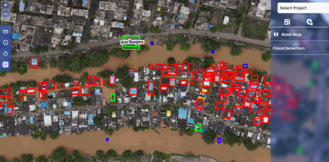
From basic spatial operations to complex GIS analysisGeoAI Functionality
Use AI to derive insights, detect anomalies, and optimize spatial decisionsLive Project Monitoring
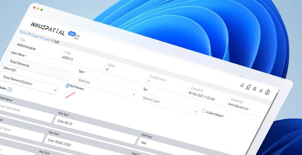
Assign areas, track progress, and monitor field teams in real timeProfessional Mapping Interface
Edit, style, and manage maps with ease“Bring Your Own DB” Integration
Connect seamlessly with your existing data systemsHow NeuSpatial Works?
-
Design Smart Workflows
Use no-code tools to build surveys, data forms, and GIS workflows specific to your use case. -
Collect and Integrate
Capture field data efficiently and plug into your existing database through BYO-DB support. -
Analyze with GeoAI
Apply geoprocessing and machine learning to uncover patterns, trends, and risks in your spatial data.
-
Visualize and Track
Use live dashboards and map views to monitor operations, manage teams, and keep QAQC in check. -
Act with Confidence
Make faster, more informed decisions with AI-powered recommendations and real-time visibility.
From field to dashboard—NeuSpatial helps you collect, analyze, and act on spatial data with accuracy and agility.
Why Choose NeuSpatial?

Bring Your Own DB
Seamlessly integrate your existing data ecosystem—no vendor lock-in or forced migration.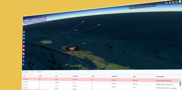
End-to-End GIS in One Platform
No more switching tools—NeuSpatial handles everything from data capture to final visualization.
Zero-Code Customization
Adapt the platform to your operational needs—no coding or developer dependency required.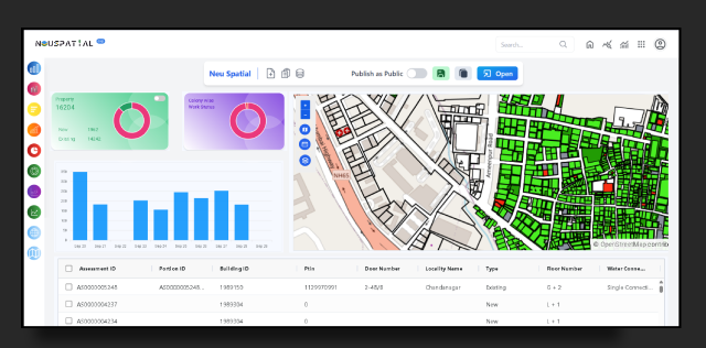
AI-Driven Spatial Intelligence
Make smarter decisions with built-in GeoAI models and advanced analytics.